Sources
Campbell Gibso, “Population of the 100 Largest Cities and Other Urban Places in The United States: 1790 to 1990,” June 1998, Working Paper Number Pop-Wp027.
“Growth of the City of Hartford,” The Hartford Courant, 29 October 1904.
Hartford (Conn.). The charter and revised ordinances of the city of Hartford, with the amendments and other acts, relating to the charter, in force May 1st, 1873. Hartford: Press of Case, Lockwood & Brainard, 1873.
Hartford (Conn.) The compiled charter and revised ordinances of the city of Hartford: including all amendments to the charter and all ordinances in force October 1, 1907, with an appendix containing all ordinances enacted from October 1, 1907, to May 1, 1908. Hartford: Case, Lockwood & Brainard Co, 1908.
Hartford (Conn.). 1788. By-laws, of the city of Hartford: At a meeting of the mayor, aldermen, Common-Council and freemen, of the city of Hartford, legally warned, and held at the State House, within and for said city, on the 10th day of November 1788.
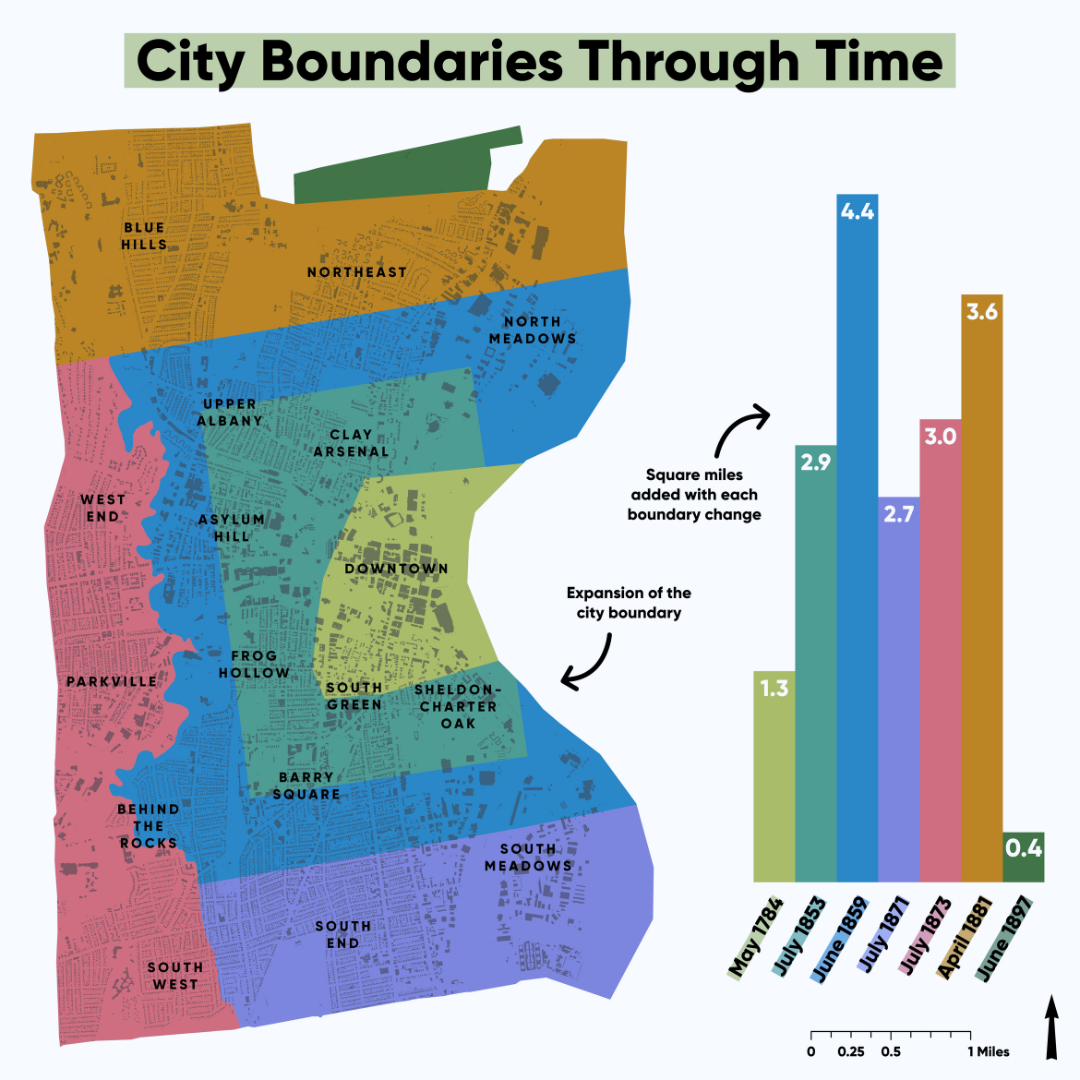
City of Hartford Boundaries Through Time
Hartford Through Time
Description
Hartford’s present extent of 18 square miles is an artifact of town and city amalgamation between 1784 and 1896. The census conducted a few years after incorporation estimated the city’s population to be 2683. Each charter revision redefined the city in relation to its commercial business district as well as the future suburbs of East Hartford, Manchester, and West Hartford. By 1881, the town and city had coterminous boundaries and consolidated government followed in April 1896. Native American, European, and African communities shaped the early histories of mobility, displacement, dispossession, and settlement in Hartford. The three Great Migrations of African Americans, West Indians, and Puerto Ricans would shape the twentieth-century trajectory of the city as earlier generations of European migrants had done before them.

Hispanic Heritage Month: CT Tobacco Industry Impact on Diversity
